Category:Langton Herring
Jump to navigation
Jump to search
English: Langton Herring is a village in west Dorset, England, situated beside The Fleet Lagoon (see Chesil Beach), four miles north east of the town of Weymouth.
village and civil parish in Dorset, United Kingdom  | |||||
| Upload media | |||||
| Instance of | |||||
|---|---|---|---|---|---|
| Location | Dorset, South West England, England | ||||
 | |||||
Subcategories
This category has the following 3 subcategories, out of 3 total.
C
- Langton Cross (2 F)
P
Media in category "Langton Herring"
The following 68 files are in this category, out of 68 total.
-
 A cove in the Fleet at Herbury - geograph.org.uk - 1234334.jpg 640 × 477; 100 KB
-
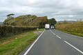 B3157 approaching Langton Cross - geograph.org.uk - 5965661.jpg 1,024 × 684; 199 KB
-
 B3157 at Langton Cross - geograph.org.uk - 1021313.jpg 640 × 428; 68 KB
-
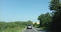
 B3157 near Rodden - geograph.org.uk - 351825.jpg 640 × 431; 72 KB
-
 B3157, Langton Herring - geograph.org.uk - 6219314.jpg 3,263 × 1,714; 1.42 MB
-
 B3157, Langton Herring - geograph.org.uk - 6219316.jpg 3,263 × 1,760; 1.32 MB
-
 Beach on West Fleet - geograph.org.uk - 6024542.jpg 1,024 × 768; 149 KB
-

-
 Boats near Langton Hive Point - geograph.org.uk - 1554102.jpg 640 × 480; 76 KB
-
 Bridge Lane - geograph.org.uk - 394708.jpg 640 × 480; 62 KB
-
 Bridle path on Rodden Ridge - geograph.org.uk - 1092303.jpg 640 × 428; 91 KB
-
 Bus stop, Langton Herring - geograph.org.uk - 4848808.jpg 640 × 570; 111 KB
-

-
 Chesil Beach at Langton Herring - geograph.org.uk - 30986.jpg 640 × 424; 88 KB
-

-
 Countryside near Langton Herring - geograph.org.uk - 1022421.jpg 640 × 428; 53 KB
-
 Countryside near Langton Herring - geograph.org.uk - 1092302.jpg 640 × 428; 65 KB
-
 Field by SWCP - geograph.org.uk - 5819569.jpg 2,048 × 1,536; 1.55 MB
-
 Footpath to the Fleet - geograph.org.uk - 421791.jpg 640 × 391; 129 KB
-
 Footpath, Rodden Ridge - geograph.org.uk - 1360676.jpg 640 × 481; 136 KB
-
 Footpath, Rodden Ridge - geograph.org.uk - 1360694.jpg 640 × 481; 184 KB
-
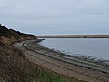
 Gore Cove - geograph.org.uk - 6024547.jpg 1,024 × 768; 124 KB
-
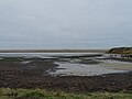
 Gore Cove, The Fleet - geograph.org.uk - 5009556.jpg 640 × 427; 48 KB
-
 Ivy Cottage, Langton Herring - geograph.org.uk - 5523314.jpg 640 × 427; 111 KB
-
 Lane, Langton Herring - geograph.org.uk - 3562650.jpg 2,304 × 3,072; 1.9 MB
-
 Langton Buildings - geograph.org.uk - 394702.jpg 640 × 480; 115 KB
-
 Langton Cross - geograph.org.uk - 5009538.jpg 640 × 427; 54 KB
-
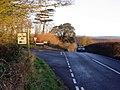 Langton Cross on the B3157 - geograph.org.uk - 351819.jpg 640 × 480; 105 KB
-
 Langton Cross, fingerpost - geograph.org.uk - 3383571.jpg 1,024 × 768; 235 KB
-
 Langton Herring - geograph.org.uk - 1021375.jpg 640 × 428; 108 KB
-
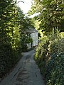
 Langton Herring Church and village - geograph.org.uk - 394692.jpg 640 × 480; 103 KB
-
 Langton Herring Dorset - geograph.org.uk - 1092269.jpg 640 × 446; 90 KB
-
 Langton Herring Dorset - geograph.org.uk - 1092271.jpg 640 × 428; 74 KB
-
 Langton Herring Dorset. - geograph.org.uk - 1092272.jpg 640 × 428; 89 KB
-
 Langton Herring, Dorset. - geograph.org.uk - 1092270.jpg 640 × 419; 81 KB
-
 Langton Herring, postbox № DT3 68 - geograph.org.uk - 1887310.jpg 480 × 640; 98 KB
-
 Langton Herring, shelter - geograph.org.uk - 3383582.jpg 1,024 × 768; 161 KB
-
 Langton Herring, thatched cottages - geograph.org.uk - 3383603.jpg 1,024 × 768; 174 KB
-
 Langton Herring, The Elm Tree Inn - geograph.org.uk - 3383639.jpg 1,024 × 768; 162 KB
-
 Lime Kiln near Rodden - geograph.org.uk - 1092304.jpg 640 × 428; 118 KB
-
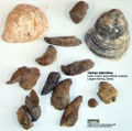 O hebridica.jpg 980 × 974; 815 KB
-

-
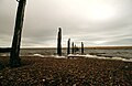 Old jetty, Langton Hive Point - geograph.org.uk - 5059353.jpg 5,068 × 3,280; 1.6 MB
-
 Ordnance Survey Cut Mark - geograph.org.uk - 4935631.jpg 640 × 616; 186 KB
-
 Pheasant Feeders near Rodden Ridge. - geograph.org.uk - 1092305.jpg 640 × 471; 110 KB
-
 Pine stand, Herbury, The Fleet - geograph.org.uk - 3562655.jpg 3,072 × 2,304; 1.95 MB
-

-
 Quaint cottage at Langton Herring - geograph.org.uk - 516415.jpg 429 × 640; 127 KB
-
 Raised Footpath - geograph.org.uk - 1554074.jpg 480 × 640; 153 KB
-
 Repairing the wall along the footpath - geograph.org.uk - 410492.jpg 640 × 480; 90 KB
-
 Restored dry stone wall, Langton Herring - geograph.org.uk - 94293.jpg 640 × 480; 227 KB
-
 Rodden Hive - geograph.org.uk - 1989975.jpg 1,024 × 682; 185 KB
-

-
 Slipway at Langton Hive Point - geograph.org.uk - 5422993.jpg 1,024 × 768; 148 KB
-
 South West Coast Path approaching Rodden Hive - geograph.org.uk - 5422988.jpg 1,024 × 768; 332 KB
-
 Sprouting Field near langton herring - geograph.org.uk - 1021312.jpg 640 × 428; 103 KB
-
 Telephone box, Langton Herring - geograph.org.uk - 1360666.jpg 640 × 480; 142 KB
-
 The Elm Tree Inn - geograph.org.uk - 3880863.jpg 640 × 480; 73 KB
-

-
 The Fleet off Langton Hive Point - geograph.org.uk - 1989968.jpg 640 × 426; 75 KB
-
 Under Cross Plantation - geograph.org.uk - 1989954.jpg 1,024 × 682; 232 KB
-
 View to Herbury - geograph.org.uk - 5422997.jpg 1,024 × 768; 200 KB
-
 Wave, Chesil Beach, Dorset - geograph.org.uk - 803925.jpg 640 × 480; 117 KB
-
 West Fleet - geograph.org.uk - 5819579.jpg 2,048 × 1,536; 1.26 MB
-
 West Fleet - geograph.org.uk - 6024540.jpg 1,024 × 768; 128 KB
-
 West Fleet - geograph.org.uk - 6024546.jpg 1,024 × 768; 156 KB
-
 West Fleet 2 - geograph.org.uk - 5819583.jpg 2,048 × 1,536; 1.3 MB
-
 Wyke Wood near Langton Herring - geograph.org.uk - 161496.jpg 640 × 480; 288 KB


